
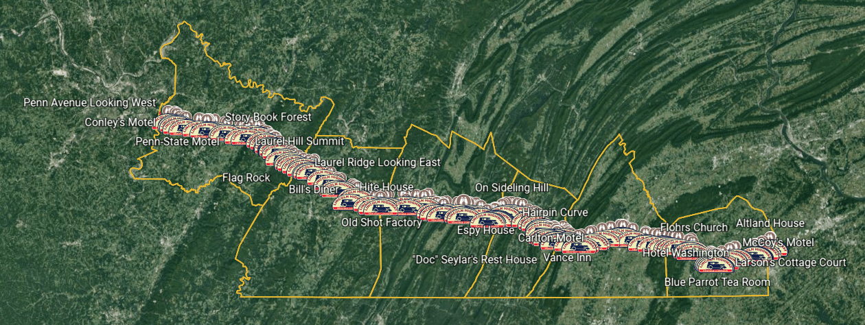
This project maps the original and subsequent routes of the Lincoln Highway through Pennsylvania from Adams County in the east to Westmoreland County in the west. The Lincoln Highway Association's interactive map was used as a basis for the routes, with modifications derived from historical maps, and from Penn Pilot Historical Aerial Photographs of Pennsylvania.
Featured are more than 350 vintage postcards from over 260 sites along the 200 miles of highway, with scans of the postcards embedded in the map at the locations where the postcard photographs were taken. Information about each location is provided, as well as a side-by-side comparison of the postcard and the scene in present day. In many cases, historical aerial photographs and satellite images are used to identify buildings and features that have since disappeared from the landscape. Where available, each site includes a link to Google Street View.
So step back in time to see how the landscape and landmarks have changed from the day the postcard photographs were taken, to the Lincoln Highway we still enjoy today.
Here are a few tips:
--- We recommend clicking the "Present" button to step through the project, or to open the Table of Contents and navigate to a location of interest.
--- Please see the second slide for the map legend.
--- Click on the photos in the info box to go full screen.
--- Follow the links in the info box for additional information.
--- Email lhmapproject@lhhc.org with comments or questions.
All images copyright 2023 by the Lincoln Highway Heritage Corridor.